
I want to start off this new year recapping the last 6-8 weeks of activity in the Indian Ocean area, where research is ongoing and activity has not even come close to ceasing. Just to show off how things have been, below is an visible image from Meteosat 7, provided by NRL. Here we see two active tropical cyclones: the now gone Cyclone Thane in the upper corner, and Cyclone Benilde in the lower portion of the image.

Cyclone Thane in particular caused some significant damage to India's southeastern coast, uprooting several treen, causing power outages and claiming the lives of at least 42 people according to several news reports (Click here for some images of the aftermath of Thane). Below is a loop of IR images from Meteosat 7, showing the cyclones developing and moving westward, with Thane making landfall in the Indian coastline.

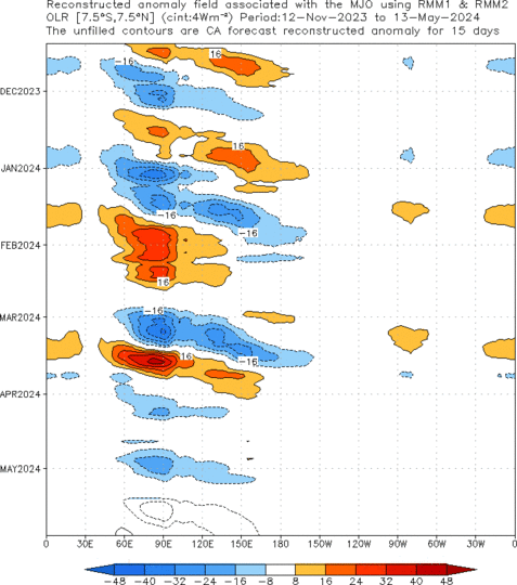
What is trully fascinating about these two cyclones is that their birth may largely be due to the rejuvenated (or newly formed) active MJO phase. In the image below, provided from NOAA's CPC, you can see the restart of OLR anomalies in the Maritime Continent sector. It's remarkable to see that, up to this moment, the anomalies associated with the MJO have had a similar pattern in OLR, particularly in their initiation part. I'm personally a little hesitant to say that this late December event is completely new, but from this picture, it almost looks like a new one started just further east than the other events.
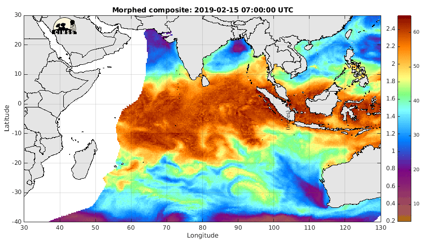
In the MIMIC-TWP loop below you can see both cyclones taking up moisture from the active MJO and from the apparent ITCZ in the southern Indian Ocean. It is also interesting to see some moisture from the remnants of Thane coming offshore on the western coast of India. Additionally, notice the dryer air mass creeping into the Maritime Continent.
The following loops shows a vertical cross section of moisture convergence over the Indian Ocean region for the last two months. When an MJO starts over the region convergence has much more vertical reach. Also, it seems to happen all over the region, making the method of initiation seem even more mysterious.


No comments:
Post a Comment