
 |
| Global mosaic of IR imagery from University of Washington |
We have two tropical cyclones in the southern Indian Ocean: Alenga and TS2. While I have not been closely following the development of these storm, it appears that they developed from meandering gyres from the MJO. These provide a good amount of vorticity and a moist environment that favors development. Neither seem to be a threat for land at this moment.
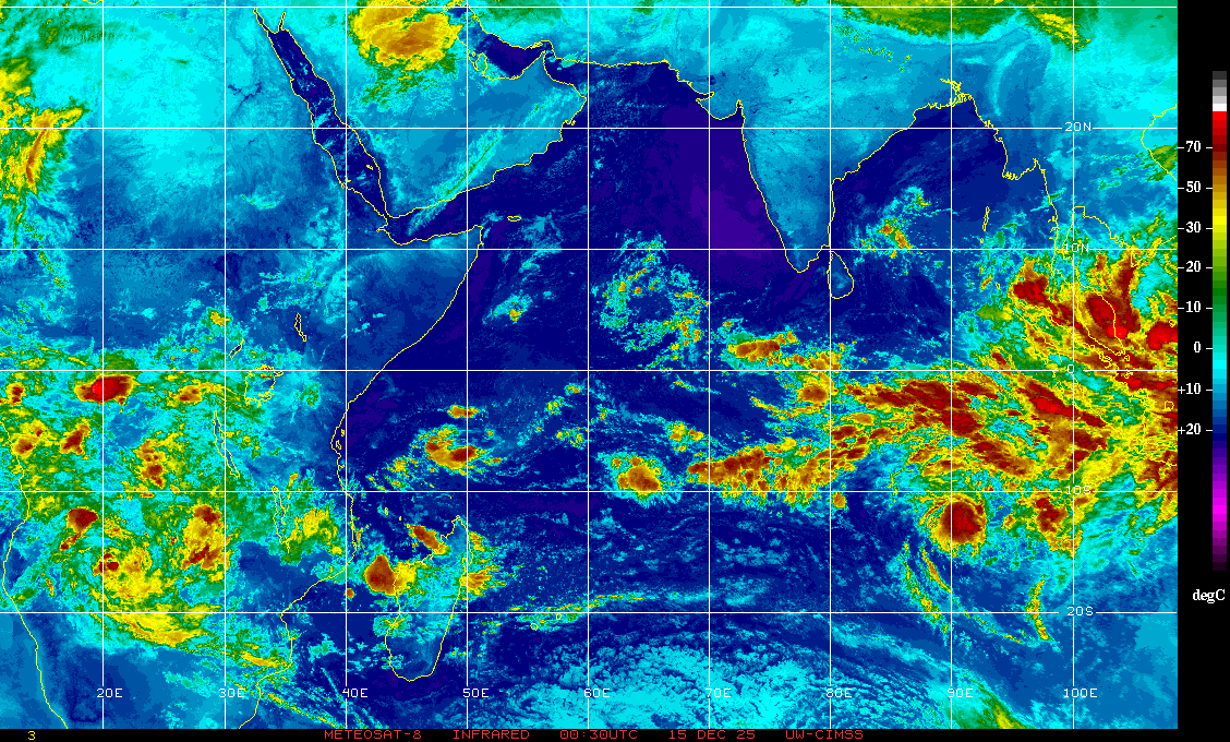 |
| At the center we have the two tropical cyclones (2 to the right and Alenga to the right) The intense cloud activity to the far right is due to the active MJO |
Well this is pretty much all I am able to write about right now, I will make another post in the future with more details of tropical weather conditions.
Angel
No comments:
Post a Comment