Saturday, December 31, 2011

[Res] Recapping the last active MJO

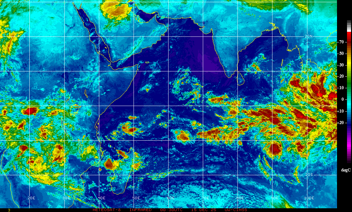
I want to start off this new year recapping the last 6-8 weeks of activity in the Indian Ocean area, where research is ongoing and activity has not even come close to ceasing. Just to show off how things have been, below is an visible image from Meteosat 7, provided by NRL. Here we see two active tropical cyclones: the now gone Cyclone Thane in the upper corner, and Cyclone Benilde in the lower portion of the image. 

Cyclone Thane in particular caused some significant damage to India's southeastern coast, uprooting several treen, causing power outages and claiming the lives of at least 42 people according to several news reports (Click here for some images of the aftermath of Thane). Below is a loop of IR images from Meteosat 7, showing the cyclones developing and moving westward, with Thane making landfall in the Indian coastline. 


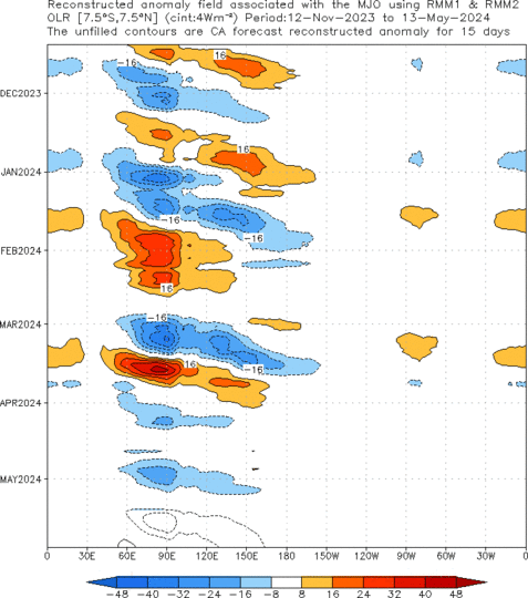
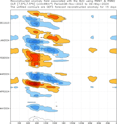
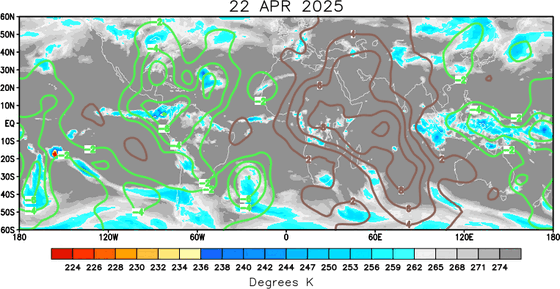
What is trully fascinating about these two cyclones is that their birth may largely be due to the rejuvenated (or newly formed) active MJO phase. In the image below, provided from NOAA's CPC, you can see the restart of OLR anomalies in the Maritime Continent sector. It's remarkable to see that, up to this moment, the anomalies associated with the MJO have had a similar pattern in OLR, particularly in their initiation part. I'm personally a little hesitant to say that this late December event is completely new, but from this picture, it almost looks like a new one started just further east than the other events. 


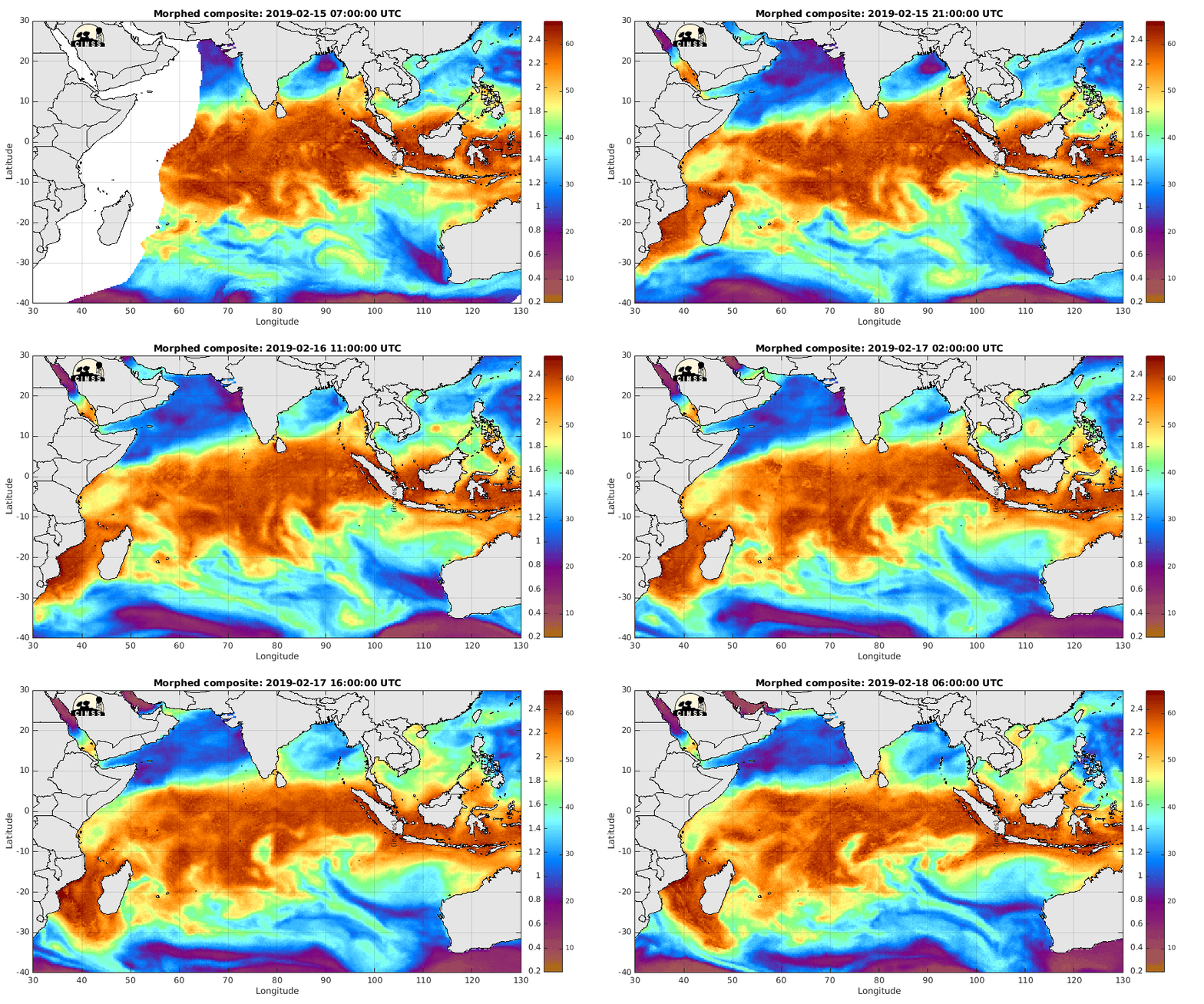
In the MIMIC-TWP loop below you can see both cyclones taking up moisture from the active MJO and from the apparent ITCZ in the southern Indian Ocean. It is also interesting to see some moisture from the remnants of Thane coming offshore on the western coast of India. Additionally, notice the dryer air mass creeping into the Maritime Continent.

The following loops shows a vertical cross section of moisture convergence over the Indian Ocean region for the last two months. When an MJO starts over the region convergence has much more vertical reach. Also, it seems to happen all over the region, making the method of initiation seem even more mysterious. 


The followig loop shows the 200 hPa moisture convergence and it's irrotational wind vectors for December 2011. Notice how when the December event strengthens, things start bubbling up in this region.  Overall things that makes one ponder about the dynamics of tropical instability

Wednesday, December 28, 2011

Nearing a close: 2011


I always love to make some sort of writing at the end of the year, mentioning some of the most memorable things. This year is no exception, it's been a special year. As 2010 marked a year of personal transformation, 2011 has been a year of continued growth.
In some ways it is also like every other year. You know, life has to go on, and it does every year. For me funny things have to happen to me every year, and this year was no exception. A few noteworthy things were:

1. I lost my keys and had broke into my own apartment.  I got in but still looked like a crook. I had some explaining to do to my neighbors after that!
2. Went snorkeling on the Florida Keys, got a cramp, everybody thought I was getting attacked by a shark.
3. Bought my 14th set of headphones (that I recall) since high school. This time I was smart enough to put a 2 year warranty on it. I finally learned!

Ok that's done with. Overall I feel like I have learned so much this year. I began research as a graduate student. That means that now I read scientific papers on a weekly basis. I am in no way near being an expert right now, but I have realized that there is just so much to learn in my field!!

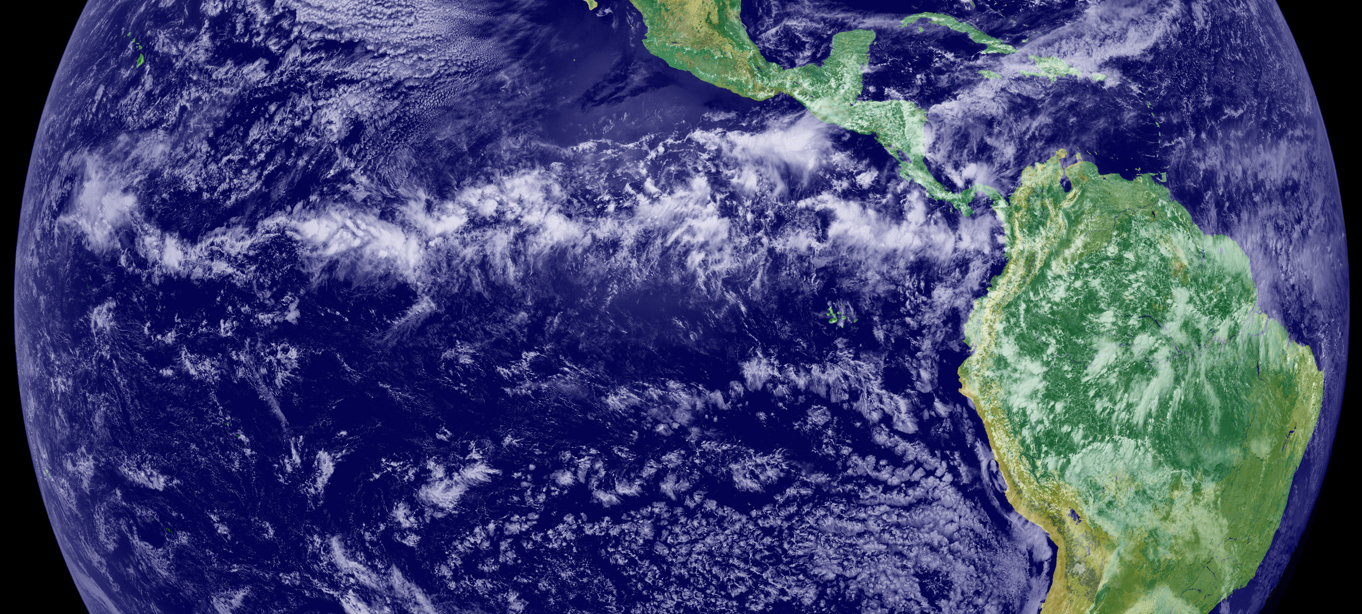
Just look at the image below. Now normally one would just see the picture and say "Woah look at the clouds", or something like that. Nowadays I look at it and think "Wow that looks like complicated physics". You change like that. In a way you kinda become a little more insane, but not in a bad way.


In many ways I think this year by far has been two things. First of all I think it's been my most successful year professionally.  There is only one reason behind this: I just worked a little harder. I got my serious groove on and did an hour more of work per day. It has made a big difference. It doesn't mean I don't take breaks, I do, I am just better at organizing my time now (though I still get those moments in which I just sit on my exercise ball and do nothing).


Out of the things that 2011 has brought me, one is this obsession of constantly looking at what's going on in the Indian Ocean. A lot of the times it's kinda boring, but sometimes interesting things can brew, like on the loop below.


I guess that's just how it is sometimes. Just take the PhD comic below and substitute the question marks by the loop above, and you get my life on weekdays!


Well okay so maybe it's a little more than that. It's more like thinking about weather instruments, classes, research and donuts! Ok that's not true either! It's a pretty normal life actually, which is pretty much what I always wanted anyways.


Ok so I'm done with this post. Here's saying goodbye to what's probably been my happiest year so far (seriously). So it is with a little bit of sorrow that I say goodbye to it! Here's hoping for a great 2012!

Still merging science with wacky
Ángel F


Wednesday, December 21, 2011

Latest activity over the tropics

It's been a couple of days since I've posted an entry. Well, to be honest I am currently on Christmas break, so things have been going slow, especially since I am at home in PR. By no means this means that I am taking a break from everything!

The last couple of days have been fairly interesting in terms of tropical activity. The biggest story has been tropical storm Washi, which could become one of 2011's most deadly disasters, with the current death count nearing a thousand in southern Philippines. It has not been a major headline but it has been mentioned in several websites, like CNNthe Australian, Washington Post, and other sources.


The Moderate Resolution Imaging Spectroradiometer (MODIS), on NASA's Terra satellite was able to capture this visible image of the cyclone on December 16.  While not a particularly powerful storm, the combination of heavy rains and the island's terrain (topography, flora, agriculture) are likely the main cause of the deadly flash floods and landslides that claimed the lives of hundreds and left thousand of others homeless.


Elsewhere in the tropical region, some interesting activity has been occurring over the Caribbean region, as the remnants of a cold front affects the area (seen as the line of moisture moving southward in the CIMMS TPW loop) . While these cause great changes in temperatures in the continental U.S., here they're mostly known for modest changes and temperature and light rain. The NWS in San Juan, PR calls for a low to medium chance of showers during the next couple of days as more of these systems keep affecting the area. 


To put things in a clearer perspective, the North American Mesoscale Model (NAM), as well as other numerical models, continue to forecast several bands of these frontal systems to move into, and linger, over this region the next couple of days.

Forecast for sea level pressure (contours), precipitation (colors), and vorticity maxima (red crosses) from the NAM model. Image from UW's weather loops.
A global stiched IR image from NRL shows a resurgence of cold clouds in the Eastern Indian Ocean/Maritime Continent region as seen in the image below. Data from NOAA's Climate Prediction Center (CPC) suggest's that the MJO has restrengthened after stalling in that area.


A cross section of moisture convergence (from the 12 EST GFS analysis) over the Indian Ocean sector shows that, once again, convergence is considerably strong, even at mid levels, as can be seen in the image below. Vertical motion also has considerably increased.
Mosture convergence cross section
Perhaps more informative is a time series of moisture convergence going back in time to 700 hours.  The first maxima shown in the plot was in mid November, when the active phase entered the Indian Ocean region. Convergence rapidly declined as the area became dominated by the suppressed phase. It is worth mentioning that while the current moisture convergence values are not quite as high as before, they have been on the rise. I doubt they will reach values as high as they did before, since the MJO will likely propagate away from the area (or weaken), sometime in the next week or two.

Saturday, December 10, 2011

The tropics, my home, part 3: Beyond the clouds

Prepare for a long entry! And by the way, even though some I put links on the same names over and over, I may be putting new websites that might be of interest to the reader. 

On the last post from this series I wrote about a little bit about tropical clouds, rain, and how they influence our culture and lifestyles (with one last picture below). Today I will talk on what moves around these clouds, and give a story on things I’ve learned about the tropics through the years that have made it an even more interesting place to me!
The ñapa picture of a sunset behind some activity. Picture courtesy of Gian A. Villamil (Physics/Meteorology UPRM)
During the year 1995 we had a very active hurricane season. This was actually the first season I can recall almost completely (I was like 7 back then). Interestingly, this marked the beginning of as series of active seasons that’s still ongoing; largely attributed to the Atlantic MultidecadalOscillation (get used to oscillations, we like to name our phenomena the “Blah Blah” Oscillation, it’s that or the “Yata Yata” Mode or the “Some Guy’s” Wave).

So it was 1995.  It was late August/early September. It was near my birthday, and we had this approaching system. It developed from what we call African Easterly Waves , whose signature can often be traced in those westward moving cloud clusters. That benign looking cluster developed into monster truck of a hurricane, named Luis. That hurricane (by then a large category 4 in the Saffir-Simpson wind scale) started lurking in our area, and the media starting buzzing about it. Being a puertorrican myself, and knowing how we are, I give my good word that I am not exaggerating when I quote:

            “Every supermarket, grocery store and Walgreens was left barren.”

Hurricane Luis

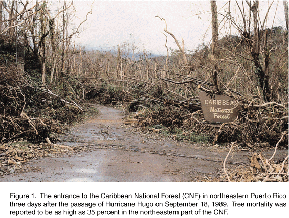
This was a big deal; it was the first hurricane since Hugo in 1989 slaughtered almost every leaf in El Yunque (it's even documented in a journal, pic below). Because of this it was understandable that people overreacted (although we overreact for every hurricane). I recall my dad putting metal and wooden bars in every window of our house, and considered taking down some of the trees in our backyard because of their potential danger to our house. In the end not much happened. Luis curved northward and we got spared. 
Image from the USGS report on Hugo's damage on the El Yunque region 
Later that year we got threatened by more systems, including a scrape from Marilyn.  The last one people talked about was Sebastien, which fizzled off without even getting close, so much for that one.

Hurricane Marilyn
Tropical cyclones are a special thing. In terms of atmospheric things they are not very common, with roughly about 90 tropical storms, and a fraction of that becoming strong enough to be called hurricanes, typhoons, etc. You need several conditions for them to develop,  and some more stuff for them to get big and strong. I like to think about most tropical phenomena as types of vehicles. In this sense, hurricanes are a sort of fancy car.  Compared to other vehicles, they are more powerful, beautiful and expensive. 

A fancy car.

So, if hurricanes are fancy cars, then what are the other cars then? Well it so happens that the tropical atmosphere is full of waves and disturbances moving about. It can be to the east, or to the west, fast or slow. One particularly active place is the Intertropical Convergence Zone. This is one of the most energetic places on Earth, with giant clouds towering many kilometers up in the atmosphere.  This area is responsible for a good fraction of the planet’s rainfall. You can easily recognize the ITCZ by looking at a map of the planet and seeing this thin belt clouds close to the Equator. In a way, the ITCZ is like the tropics’ highway.


There are also some bigger things that like to move around. There is the behemoth I’ve been mentioning a lot in my entries called the Madden-Julian Oscillation. This guy is like a carrier truck, a big truck that can carry many other vehicles in it. They are pretty slow but tend to enjoy ruling the road. They are also not as common as cars and motorcycles.


Of course, I did not know of most of these things when I was a kid. All I knew back then were tropical waves, hurricanes and clouds, and I thought that was pretty awesome. I learned of these, more complicated things in college, particularly grad school. Learning about these things has made me realize how dynamic the sky I used to watch as a kid actually is, and how complex it is.  It is so complex that there are some phenomena that have been studied for decades by some of the world’s brightest people and there is still a lot to be understood about them.

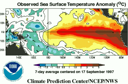
But that’s not the end of it. There are even more things going on. Ever heard of the El Niño Southern Oscillation (remember when I mentioned that we like to call everything an oscillation, there you go!). This is a coupled ocea-atmosphere phenomena that has implications all over the world. A particular case happened in 1997, which people call it the El Niño of the century. It was extremely strong, and its effects made constant headlines on the news (look at the animation of all the super typhoons that year).  It comes to show you just how something that happens in one place in the planet can affect everything. Like I said in a previous post, it really is just one Earth.


But why confine myself to where clouds form. Way up in the tropical stratosphere we have an interesting thing going on. It’s a shift in the winds that has the name of the Quasi-Biennial Oscillation (yet another oscillation!).

So there you have it, there are so many things going on it almost makes your brain explode.  The place I was born in and the place I’m currently dedicating my career to: the tropical atmosphere. I’m not alone in this, because there are conferences just dedicated to this topic in which hundreds attend. What can I say, it’s a pretty awesome place with huge clouds and beautiful beaches. What else can a guy ask for? 

Thursday, December 8, 2011

Earth Interactions

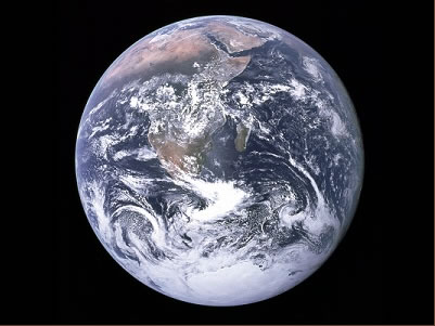
Have you ever thought about our planet, how beautiful it is? Have you gone deeper and thought about how it works? It's complicated stuff, right? There are so many aspects that our planet has that we know so little about. Here at the American Geophysical Union's Fall meeting a huge amount of people are trying, little by little, to further understand our planet.

Our planet
We divide our planet into several different branches and tend to study them individually. However, even though we like to do that, we also know that different aspects of our planet tend to interact with each other in ways unimaginable. Such were the topics of some of the lectures given here.

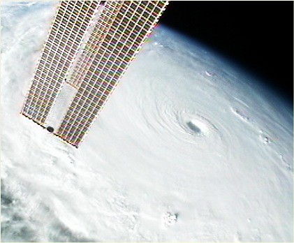
One such talk that I found fascinating was given out by University of Wisconsin professor Jonathan Martin. It started up with a simple question. What does the October 2010 "bomb" storm, one of the most intense extratropical cyclones of all time,  have in common with a western pacific super typhoon that went with the name of Megi? (pictures below)

October 2010 system. 
Super Typhoon Megi as seen by International Space Station.

The story is not all too complicated. It starts off with the powerful typhoon moving to the northwest. As it moved poleward, it carried it's high-reaching clouds with it. The air in these clouds are much warmer than the surrounding air, as it was lifted from the very warm tropical boundary layer and warmed by the release of energy from condensation.  This air began to interact with upper-tropospheric features. It caused a merger of the subtropical jet and the polar jet. Moreover, the warm tropical air caused the an increase in temperature gradient over the jet area. The end result was a monster jet that roared with incredibly strong winds.

Aside wreaking havoc to whatever it touched, what else can a typhoon be capable of?
The warm air that caused the monster jet moved eastward, towards the US. This plot is obtained from Martins presentation, which can be found on his website. 

Now normally this would not be a big deal. Jets are high enough that, would they not interact with anything else, they might just be trouble to airplanes flying through it.  But in our atmosphere this is not the case. Things interact with each other in very interesting ways. So when this jet reached the US,  and closed in on a developing cyclone, trouble brewed.  When the area of high winds moves around a trough it has large value of vorticity. This can enhance the deepening of extratropical cyclones, and this was the case. The end result was a record setting "bomb" that caused widespread damage over the U.S. 
NOAA surface analysis depicting the impressive storm of Oct 26 2010. 

This was not the only talk that mentioned interesting interactions within the Earth System. Another scientist was mentioning the potential of deep convection in the tropics to affect signals in the ionosphere, and another one mentioned how you can see the signal of strong storms in seismographs and measure the effect of these in the rotation of the Earth. 

This is just the tip of the iceberg when we talk about interactions. The talks about it have been numerous, and I've not been able to attend them all. It is truly amazing in the many ways the different features of our planet interacts, it can make anybody intimidated to tackle these problems. But it does give an interesting thought. No matter how many topics you divide the Earth Science into, you have to always remember that it is still just one Earth, our Earth. It is complex, yet beautiful; tough, yet frail. Any small change done to it can lead to major consequences somewhere else. This could be in a matter of days, or centuries. 

With this said, do you think that our race,  with over six billions individuals spread all over our planet, could potentially have an effect on the different aspects of our planet? 

Tuesday, December 6, 2011

[Res] Tropical Storm Alenga and 2

Hi from San Francisco. Just wanted to take several minutes off to write up a new blog.  As we go deeper into December and winter starts setting in the northern hemisphere, it almost seems that interesting features in the tropics have calmed down. This is true for area that are close to the US (and PR),  but for some equatorial areas and the southern hemisphere there is still lots to talk about. 

Global mosaic of IR imagery from University of Washington

We have two tropical cyclones in the southern Indian Ocean: Alenga and TS2.  While I have not been closely following the development of these storm,  it appears that they developed from meandering gyres from the MJO. These provide a good amount of vorticity and a moist environment that favors development.  Neither seem to be a threat for land at this moment. 

At the center we have the two tropical cyclones (2 to the right and Alenga to the right)  The intense cloud activity to the far right is due to the active MJO
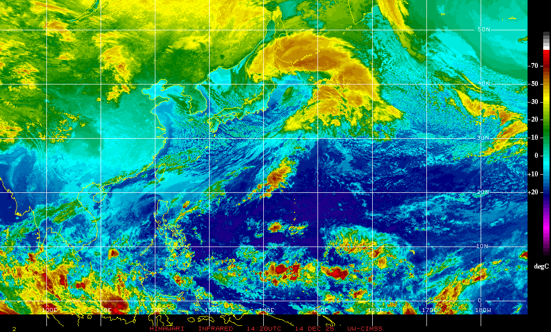
The active MJO phase is currently near the Maritime continent/ western Pacific. We can clearly see it in the enchanced satellite image below. The latest NCEP discussion forecast it to remain active, with a possibility of some weakening. This event has been fairly strong in comparison to other events this year. 


Well this is pretty much all I am able to write about right now, I will make another post in the future with more details of tropical weather conditions.

Angel

Monday, November 28, 2011

[Res] Convection and gyres

I have decided that, from now on, I will prefix [Res] to posts in which I will talk about things closely related to what I study. I will still try to make them as simple as possible though!

Just wanted to make a quick update on interesting things I've seen on the latest active MJO, which is now creeping close to the Maritime continent, as seen in the latest water vapori image from NRL. First of all, check out all those deep colors there!  Also, take a look at TS 5  a little north going to an inevitable landfall.


But what has really been  getting my attention lately has been all the apparent rotation that the model analyses keeps showing. Below is a plot of non-divergent winds and vorticity contours (Note that for this plot, negative values in the southern hemisphere is cyclonic).  There are four clear cyclonic gyres in the Indian Ocean right now (one of them being TS 5).


If we overlay them with satellite IR (once again from NRL), we can observe that some of them roughly correspond to cloud activity. It is worthwhile to notice that they seem to pop up more and more to the east as the MJO propagates, and grow as they move westward, although I do not have enough info to back it up solidly. This is why the MJO is considered a complex, made out of cloud superclusters and propagating waves inside the packet.  In the figure below I also added a red arrow indicating the westerly winds associated with this complex. They seem to have maintained the same strength through the last couple of days.

Mosaics of the World

On this entry I just want to post some global images. I find them very interesting since they show how different weather can be at different areas of the world at any given time. I will keep this entry simple and free of some of the technicalities and jargon of our field.

The first one is a global mosaic image of water vapor obtained from the University of Washington's dataset.  In this image we can appreciate how different patterns dominate different latitudes. Near the equator we see a long band of patchy cloudiness. This is what we know as the Intertropical Convergence Zone (ITCZ), and we usually associate it with ascending motion and convergence of the trade winds. In previous centuries, sailors despised this area because of its tendency to be either calm (weak winds), or because of the terrible storminess associated with the ITCZ.  Clouds in this region can be very high (more than 15 km high) and very intense!

The other area that is quite apparent is in the midlatitudes. Here we see a little waviness and some big looking storms, known as extratropical cyclones. This area is dominated by the troughs and ridges that make the everyday weather of areas like the United States and Europe. These guys are usually embedded in a west to east motion that we like to call the westerlies.

Even these features just look like everyday weather patterns that just move around, making some places sunny and other rainy, they also constitute important pieces of our planet's general circulation, and are key to the poleward transport of energy, cooling the tropics and warming the poles.


In this infrarred (IR) image, obtained from the CLAUS database, we can observe the same features. Here, bright white colors denote cold temperatures. Notice how tropical clouds can be very white, evidencing how high these clouds can be. The image is more grey-ish closer to the poles because it is much colder there than in the tropics and hence the satellite captures less outgoing radiation. A lot of satellite sensors obtain their data this way and we call them passive sensors.


This last image, recently taken from CIMMS MIMIC-TPW shows some of the aforementioned features. The big line packed with precipitable water near the equator is the ITCZ, the circle is the currently active tropical storm 5, and the black rectangle is the active phase of the MJO, which I have mentioned in previous posts. There are also some interesting river-like features at higher latitudes, which is often related to moistures being carried by frontal systems and troughs. 

Sunday, November 27, 2011

More on TC's and the MJO

Thought I'd post an intermediate blog before putting another one (pt 3 of my tropics series) talking more about tropical cyclones and the MJO.

So we've had a nice fall season for MJO activity in the Indian Ocean, with a third one since September currently active over the Indian Ocean area (as can be seen in the reconstructed outgoing longwave radiation anomalies below) . There are differing forecasts on how this event will keep evolving, but it looks like the event will continue to be strong during the following week.

Velocity potentials shows what MJO phase we are currently in, showing the active phase centered over the convective region. It also gives a better perspective of the magnitude of these disturbances.


The latest loop from CIMMS MIMIC- Total Precipitable Water Vapor (TWP), shows very nicely the two gyres associated with the MJO, the area of westerly winds as well as the circulation of what now is tropical storm five (according to JTWC)! We can see as the moisture seems to migrate to the east, while the westerly winds almost appear to be fluxing drier air in. We can also observe TS 5 moving northwest as well as what appears to be the development of a new gyre close to the equator and 80 degrees of longitude.


This rotating feature (seen below), is almost looking similar to the other MJO gyres that were present previously, and is associated with a fairly large area of cloudiness.  It will be interesting to see how this new circulation feature affects the dynamics prevailing over the area at this moment, which has been largely affected by TS 5 during the last couple of days.